 YOUR PHOTOS: As Hurricane Sandy continues to roar towards New Jersey in full force, we will keep you updated in this post with all urgent and important information tidbits pertaining to Lakewood – as it happens.
Your reports will also help us keep tabs on all neighborhoods around Lakewood, so if you see something, please let us know by sending an email to [email protected], or by texting us to 415-TL-SCOOP (415-857-2667).
Also, send us your photos to [email protected] and we’ll add it to our ‘Hurricane Sandy’ album.
If you have general accurate information to share with the town, please post it in the comments section on this post.
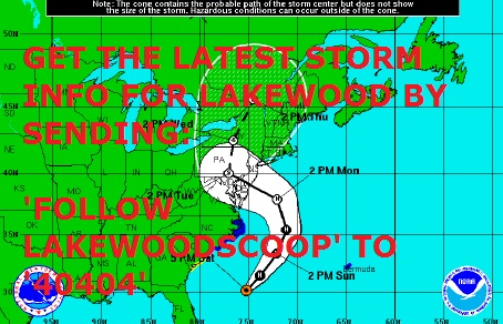
You can also get the latest storm updates for Lakewood – and other breaking news and traffic alerts – by sending ‘Follow Lakewoodscoop’ to the number ’40404′.
—————————————
UPDATE Sunday 1:45 PM: Tolls on the northbound GSP are suspended from Cape May to the Driscoll Bridge.
UPDATE: Sunday 1:56 PM. Latest storm update from Police Chief Rob Lawson:
•Hurricane Sandy will have a severe impact on our region over the next several days:
• Strong damaging sustained winds 35 to 50 mph over a prolonged period of time (24 to 48 hours), with gusts up to near hurricane strength. Strongest winds are expected south and east of the I-95 corridor.
• Extremely heavy rainfall.
• Major to record inland flooding along streams and rivers.
• Major to record coastal flooding. The full moon on October 29 just makes things worse.
• Options for the storm to miss our area are rapidly dwindling. Confidence on the storm having a major impact on our region continues to increase. The focus of efforts should be on when Sandy hits our region, not if Sandy hits our region.
UPDATE 2 PM: Christie Administration Announces Full Suspension of NJ Transit Service, Beginning this Afternoon.
UPDATE: 2:08 PM. Christie Administration Announces Full Suspension of NJ Transit Service, Beginning this Afternoon.
UPDATE 2:20 PM: Gov. Christie now in Press Conference: Worst part of storm will be Monday. Will linger for 36 hours or more.
UPDATE 2:30 PM: NWS: Coastal Flood Warning in effect from 4 PM this afternoon to midnight EDT Monday night.
UPDATE 2:45 PM: PATH Service to Be Suspended Beginning Midnight Sunday – Airlines Expected to Cease Flight Activity Tonight, and Tunnel and Bridge Closures Are Being Evaluated.
UPDATE 3:35 PM: Trash pickup schedule for Hurricane Sandy available here.
UPDATE 7:33 PM: Sunday evening in Lakewood: The rain could be heavy at times. Low around 53. Windy, with a northeast wind 25 to 31 mph, with gusts as high as 43 mph. Chance of precipitation is 100%. New precipitation amounts between a quarter and half of an inch possible.
UPDATE SUNDAY 7:45 PM: NWS: Options for the storm to miss our area are rapidly dwindling. Confidence on the storm having a major impact on our region continues to increase. The focus of efforts should be on WHEN Sandy hits our region, not iIF Sandy hits our region.
UPDATE MONDAY 9 AM: Brunt of the storm to come later in the day. Gusts of winds to hit 75 MPH in the afternoon.
UPDATE 9:10 AM: Latest satellite photo of Sandy’s path http://twitpic.com/b8h653
UPDATE 9: 20 AM: The worst of the storm is expected to hit New Jersey this evening. The eys of the storm is still over 200 miles away from New Jersey.
UPDATE 9:40 AM: GSP being shut in both direction south of exit 38.
UPDATE 9:45 AM: Governor Chris Christie Announces Federal Emergency Declaration for New Jersey.
UPDATE 10: 10 AM: Police Chief Rob Lawson: Stay off the roads. Worst to come after dark tonight.
UPDATE 11:23 AM: Governor: We have activated the Volunteer Emergency Response Hotline. If you would like to help, call 1-800-JERSEY-7.
UPDATE 11:25 AM: Mayor Miller & Police Chief: Brunt of Sandy to hit Lakewood after dark this evening.
UPDATE 11:45 PM. GOVERNOR TO HOLD PRESS CONFERENCE AT 12: WATCH LIVE http://www.livestream.com/governorchrischristie
UPDATE 12:07 PM: Gov Christie moments ago in Press Conference: WE’RE ALREADY SEEING SIGNIFICANT FLOODING – STAY OFF THE ROADS.
UPDATE: 12:17 PM: GOVERNOR: WE’RE ONLY AT FIRST 12 HOURS – WILL GET WORSE – LAST FOR ANOTHER 36 HOURS
UPDATE 1:04 PM: County offices will remain closed through Tuesday.
UPDATE 1:10 PM: Fire Chief Rodney Youmans: Stay Away From Downed Wires.
UPDATE 1:14 PM: If you lose power or see downed power lines, call JCP&L at 1-888-544-4877.
UPDATE: 1:42 PM: POLICE CHIEF ROB LAWSON “AGAIN”: STAY INDOORS – IT’S EXTREMELY HAZARDOUS OUT THERE.
UPDATE 1:56 PM: Over 2,000 in Lakewood without power.
UPDATE 2 PM: GSP WILL BE CLOSED IN BOTH DIRECTIONS SOUTH OF 129 BEGINNING AT 4PM.
UPDATE 2:10 PM: OFFICIALS: SEEK SHELTER NOW. WIRES ARE CATCHING FIRE EVERYWHERE. DON’T TAKE THIS LIGHTLY.
UPDATE: 6:45 PM: WARNING: DO NOT HEAD OUT WITH A VEHICLE. IF YOU MUST, CALL CHAVEIRIM OR LCSW PRIOR TO FIND OUT WHERE YOU CAN DRIVE – LIVE WIRES ARE DOWN IN MANY PLACES.
UPDATE: 6:45 PM: The brunt of the storm is heading our way – Sandy has already made landfall in Southern New Jersey
UPDATE 7:45 PM: Sandy now post-tropical. All warnings still in effect.
UPDATE 8 PM: LPD: WINDS HITTING RECORD NUMBERS- ASKING RESIDENTS TO REMAIN INDOORS.
UPDATE: 8:30 PM: Official projections from the National Hurricane Center have the storm moving westward through Pennsylvania and then moving north into New York. The change in designation from hurricane to post-tropical cyclone is due to a continued deterioration of the convective center of the system, characteristic of tropical cyclones and hurricanes. However, Sandy is just as dangerous – sustained 80 mph winds along with heavy rainfall, surge, and coastal and inland flooding are expected as this storm continues to move inland.
UPDATE 8:35 PM: LAKEWOOD CHAVEIRIM AND LAKEWOOD FIRE DEPARTMENTS REPEATERS ARE DOWN.
UPDATE 8:35 PM: SEE IMAGES OF SANDY MAKING LANDFALL: http://www.nnvl.noaa.gov/MediaDetail2.php?MediaID=1226&MediaTypeID=1
UPDATE 11:20 PM: TRACKING SANDY AFTER LANDFALL: VIDEO UPDATE: http://bcove.me/k6eq2gnb
UPDATE TUESDAY 8:43 AM: GOV. THE DEVASTATION ON THE JERSEY SHORE IS SOME OF THE WORST WE’VE EVER SEEN.
UPDATE 8:45 AM: GOV. GSP is now open but over 200 other state roads remain closed. Don’t drive unless you absolutely have to.
UPDATE 8:45 AM: GOV CHRISTIE TODAY AUTHORIZED THE CLOSURE OF ALL STATE OFFICES FOR TUESDAY.
UPDATE 8:50 AM: LPD: STAY HOME TODAY AS WELL. THERE ARE DANGERS ON THE STREETS.
UPDATE: 9 AM: LPD: STAY HOME TODAY AS WELL. THERE ARE DANGERS ON THE STREETS.
UPDATE 9:17 AM: ALL NEW JERSEY TRANSIT SUSPENDED UNTIL FURTHER NOTICE.
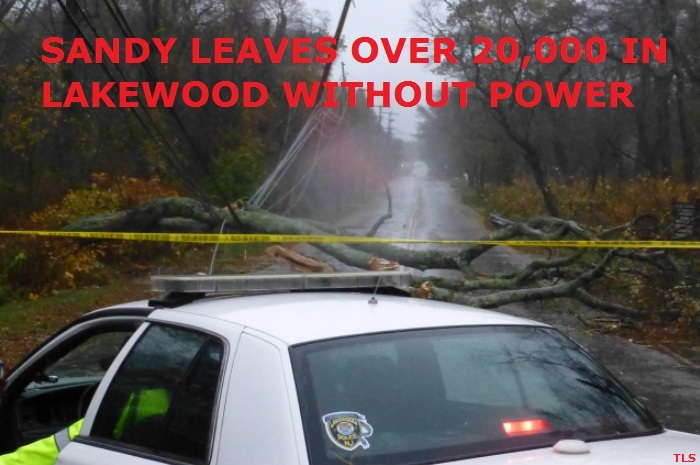
UPDATE: 9:18 AM: OVER 20k JCPL CUSTOMERS IN LAKEWOOD WITHOUT POWER – NEARLY 1 MILLION IN STATE. LPD: KEEP ROADS CLEAR OR WILL DELAY REPAIRS.
UPDATE 10:58 AM: Governor: I don’t give a d*** about Election Day after what has happened here. I am worried about the people of New Jersey.
UPDATE: 11:20 AM: LATEST BRIEFING FROM THE GOVERNOR: http://www.livestream.com/governorchrischristie/video?clipId=pla_5b4613f1-c47b-4ec5-85d1-d6294df33213&utm_source=lslibrary&utm_medium=ui-thumb
UPDATE 1:05 PM: Governor Heading By Helicopter To The Jersey Shore To Assess The damage. “From Early Reports, It Appears To Be Unthinkable.”
UPDATE 5:30 PM: Governor Christie: Just got back from surveying damage on the Shore. I’ll be updating everyone on the latest at 7:15PM. Watch live here: http://www.livestream.com/governorchrischristie …
UPDATE 7:55 PM: County Offices Will Re-open Wednesday, October 31st, With The Exception Of Those Facilities On The Barrier Islands.


I have most of my big freezer empty if you need space call 732-367-7071
Ashley avenue between Wynatt and Lincoln still has no power. It is the forgotten block in Lakewood always the last to be remembered.
MLK from Pine street to the projects at Cedarbridge is still out of power!!
does anyone know if NPGS James is open tonight ??
Orchos chaim has school tomorrow regular day with minyan they had school today also they have power
Is route 88 open?
does anyone have any idea when the internet will be up and running
Npgs on James is open-they have a huge generator!
light on in New england Village as of 9:10 PM
Lights just went back on About 15 min ago. Sunset and James area.
DLUX Family Restaurant is open with FULL MENU & SUSHI
sunset n James has power
hearthstone no power. we had a break-in last night too.
Ridge area-we dont have electricity since yesterday at 1:00.does anyone have a clue when its going on?
I have power but no internet. I have Optimum (Cable Vision). Any one else having this problem? Any idea when we will get it back?
MLK still no power. 🙁